





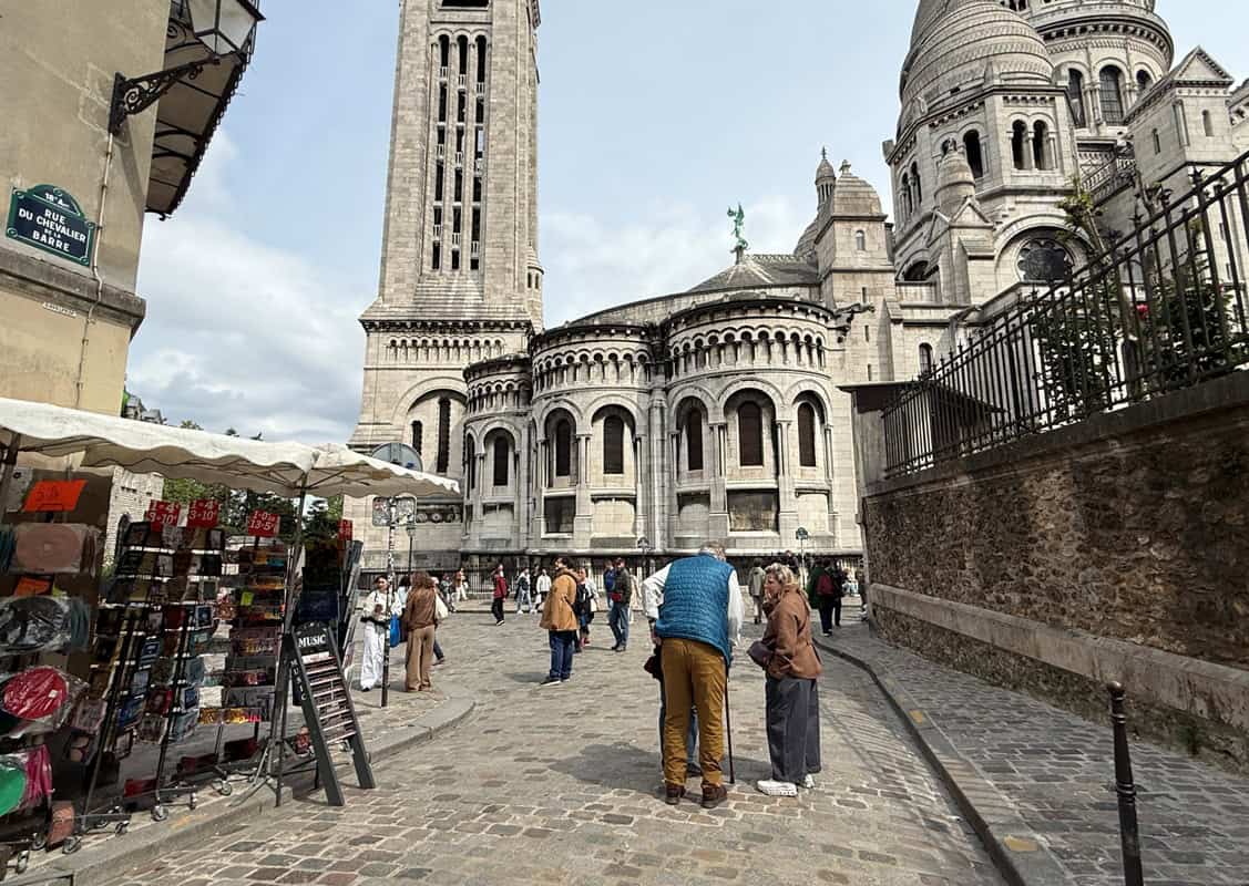
Paris is one of the great walking cities in the world. The streets are interesting, the distances between major sights are manageable, and a lot of what makes the city worth visiting is found at street level rather than underground. A walk along the Seine on a clear morning, a slow afternoon through the Marais, a climb through Montmartre’s quieter streets — these are not things you find on the Métro.
But “I’ll just walk everywhere” is one of the most common planning mistakes in Paris. The city looks compact on a map and isn’t. Distances that seem short take longer than expected, particularly once you factor in stops, crossings, and the natural tendency to wander. A poorly planned day means crossing the Seine three times, backtracking through the same streets, and arriving at the Eiffel Tower after spending the morning on the wrong bank.
This guide covers how to plan walking routes in Paris so your days flow rather than zigzag.
How Far Is It Really?
The first step in planning a walking route in Paris is being honest about distances. The table below gives approximate straight-line walking times between common tourist starting points and destinations. In practice, allow a little more — you will stop for photos, wait at crossings, and occasionally take a wrong turn.
| Route | Distance | Approx. walking time |
| Eiffel Tower → Musée d’Orsay | ∼ 1.2 km | 15 min |
| Eiffel Tower → Louvre (via river) | ∼ 3 km | 35–40 min |
| Louvre → Notre-Dame | ∼ 2.5 km | 30–35 min |
| Notre-Dame → Marais (Place des Vosges) | ∼ 1 km | 12–15 min |
| Marais → Bastille | ∼ 1.5 km | 18–20 min |
| Saint-Germain → Pantheon | ∼ 1.2 km | 15 min |
| Opéra → Sacré-Cœur (base of Montmartre) | ∼ 2.5 km | 30 min |
The key takeaway: the central sights are genuinely walkable, but a full loop — Eiffel Tower to Louvre to Notre-Dame to Marais and back — adds up to 8–10 km. That is a long day on foot before you factor in time inside any attraction.
For a visual overview of walking times between Paris landmarks, the official Paris tourism office has published a free walking time map.
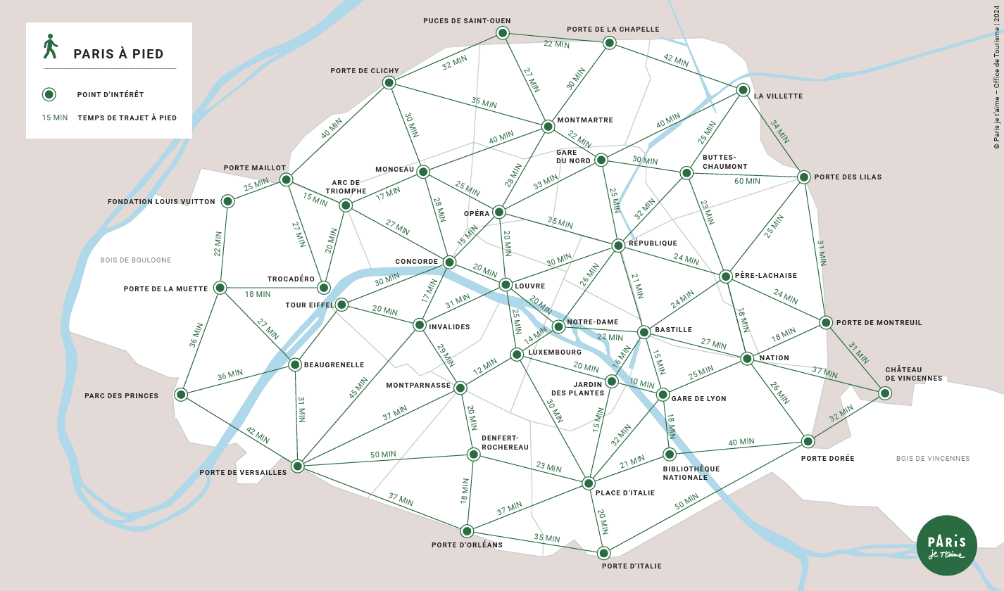
Source: © Paris je t’aime – Office de Tourisme, 2024
The Three Rules of Efficient Walking in Paris
| Route logic in three rules Plan by bank: spend half a day on one side of the Seine before crossing. Crossing multiple times wastes time and energy. Use corridors: certain streets connect multiple sights naturally. Walk the corridor and see several things in sequence rather than jumping back and forth. Anchor and explore: use the Métro for large jumps between neighborhoods, then walk freely within each one. |
Plan by Bank
The Seine divides Paris into the Right Bank (Rive Droite, north of the river) and the Left Bank (Rive Gauche, south of the river). Most of the major tourist sights fall clearly on one side or the other.
Right Bank sights include the Louvre, the Marais, the Champs-Élysées, Sacré-Cœur, and the Opéra. Left Bank sights include the Eiffel Tower, Musée d’Orsay, Saint-Germain-des-Prés, the Latin Quarter, the Panthéon, and Montparnasse.
The most efficient approach: spend a morning or half-day exploring one bank before crossing. If you start at the Eiffel Tower (Left Bank) and your next planned stop is Notre-Dame (Île de la Cité, midpoint) and then the Marais (Right Bank), that is a natural eastward progression. If instead you cross to the Right Bank after the Eiffel Tower, then back to the Left Bank for Saint-Germain, then back across for the Marais — you have crossed the river three times and added unnecessary distance.
Île de la Cité — the island containing Notre-Dame and Sainte-Chapelle — sits in the middle of the river and works as a natural transition point. Crossing there lets you shift banks without feeling like a detour.
Walk the Corridors
Paris has several natural walking corridors: streets or routes that connect multiple interesting things in sequence, so that walking along them feels purposeful rather than like point-to-point navigation.
Right Bank: the Rivoli corridor
Rue de Rivoli runs east-west along the northern edge of the Tuileries Garden, past the Louvre, and into the Marais. Walking it from the Place de la Concorde end takes you past the Tuileries (worth a detour into the garden), the Louvre’s northern wing, the Hôtel de Ville, and eventually into the Marais. This is a useful spine for a Right Bank day.
Right Bank: the Seine path
The right bank of the Seine, particularly between the Trocadéro and the Pont Neuf, offers continuous riverside walking with views across to the Left Bank. It passes under several of Paris’s most photographed bridges and remains relatively pleasant even on busy days, because tourist foot traffic disperses along the length of the river rather than concentrating at single points.
Left Bank: Saint-Germain to Notre-Dame
Starting at the Musée d’Orsay and walking east along the Left Bank brings you through the heart of Saint-Germain-des-Prés, past the Café de Flore and its neighbours, through the Latin Quarter, and onto the Pont de la Tournelle with a direct view of Notre-Dame. This corridor covers some of the most atmospheric streets in the city and can be done comfortably in a couple of hours at a slow pace.
Montmartre: the quiet streets above the tourist zone
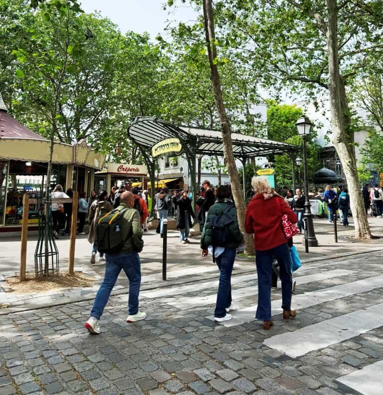
The Sacré-Cœur area is crowded, but the streets immediately to the west and east of the main tourist cluster — around Rue Lepic, the vineyard, and the quieter steps up from Abbesses Métro — are considerably calmer. Approaching from Abbesses rather than Anvers avoids the main crowd and gives a better sense of what the neighborhood is actually like. Note that Montmartre is genuinely hilly; the climb from the base to Sacré-Cœur is around 130 steps, or one Métro ticket via the funicular.
The Anchor and Explore Method
The most practical approach for a multi-sight day: use the Métro to reach the starting point of each neighborhood, then walk freely within it. This avoids the two failure modes of Paris walking — trying to walk all inter-neighborhood distances (exhausting) and using the Métro for every short trip (slow and you miss everything above ground).
A practical example: take the Métro to Trocadéro for the Eiffel Tower, then walk east along the Seine to the Musée d’Orsay and through Saint-Germain. From Saint-Germain, walk across Pont Saint-Michel to Île de la Cité for Sainte-Chapelle and Notre-Dame — it’s a five-minute walk. Walk east into the Marais. Take the Métro back to your hotel. You’ve covered four areas, crossed the river once, and walked about 5–6 km of interesting ground.
The Best Areas for Wandering Without a Fixed Plan
Some parts of Paris reward walking without a specific route. These are the areas where getting slightly lost is actually the point:
- The Marais (3rd and 4th arrondissements) — compact, dense with small streets, galleries, and cafés. Hard to go wrong. Place des Vosges is an obvious anchor; the streets around it fill the time naturally.
- Saint-Germain-des-Prés (6th arrondissement) — the area between Boulevard Saint-Germain and the river is particularly good for wandering. Covered passages, bookshops, and cafés without too much pressure to be anywhere in particular.
- Île Saint-Louis — a small island directly behind Notre-Dame, one street wide, very quiet relative to its location. Good for a short break between heavier itinerary points.
- Canal Saint-Martin (10th arrondissement) — a good choice if you want to walk somewhere that feels less like a tourist route. The canal path between the Republicè area and Gare de l’Est is pleasant, particularly in good weather.
Practical Notes for Walking in Paris
- Shoes matter more than most people plan for: cobblestones, uneven pavements, and the sheer distance add up. Comfortable, already-broken-in shoes make a significant difference to how the day feels by mid-afternoon.
- Morning is the best time to walk: lighter crowds, better light for photos, cooler temperatures in summer. The main tourist sites are noticeably less crowded before 10am.
- Rain changes the calculation: light rain is manageable with an umbrella; heavy rain makes cobblestone streets slippery and the covered passages — Passage des Panoramas, Galerie Vivienne, Passage Jouffroy — become excellent alternatives.
- Water: tap water is safe and free; Wallace fountains throughout the city provide drinking water. Bring a reusable bottle on longer walking days.
If you’d like walking with built-in context and commentary — particularly useful on a first visit when you want to understand what you’re seeing — GetYourGuide has a range of Paris walking tours covering different neighborhoods and themes.
Navigate Without Backtracking
Having your route mapped out before you leave the hotel is the simplest way to avoid the main inefficiencies: doubling back, crossing the river unnecessarily, and standing on a pavement looking at your phone trying to figure out which direction to walk.
The Paris For You app gives you offline maps and attraction information for 100+ Paris sights in 26 languages — so your route stays clear even when you don’t have a signal. Useful for the Métro, and useful for the stretches between.
If you’re still putting together your itinerary, the Paris For You trip planner can help you structure your days before you go.
Take Paris with you.
Download Paris For You and keep your offline maps close at hand, wherever the day takes you. Available in 26 languages.
Download on Android
Download on iPhone


